Laser ranging, a precise measurement technique, calculates distance by measuring the time it takes for a laser pulse to travel to a target and back. This technology relies on the constant speed of light, enabling highly accurate distance calculations. The core principle involves emitting a short laser pulse towards a target. A photodetector then receives the reflected signal. By precisely timing the interval between emission and reception, the distance is computed using the formula: Distance = (Speed of Light × Time of Flight) / 2. This method is known as Time-of-Flight (ToF) measurement.
There are two primary operational modes: pulse laser ranging and phase laser ranging. Pulse ranging, described above, is ideal for long distances, such as measuring the Earth-Moon distance. Phase-based ranging modulates the laser beam's intensity with a continuous wave and measures the phase shift of the returned signal. This method offers superior precision for shorter ranges and is widely used in surveying and industrial metrology.
The applications of laser ranging are vast and transformative. In geodesy and satellite tracking, it is indispensable. Satellite Laser Ranging (SLR) systems precisely track Earth-orbiting satellites, contributing crucial data for understanding gravitational fields, plate tectonics, and Earth's rotation. The iconic Lunar Laser Ranging experiments, using retroreflectors placed by Apollo missions, continuously measure the Moon's distance, testing theories of gravity.
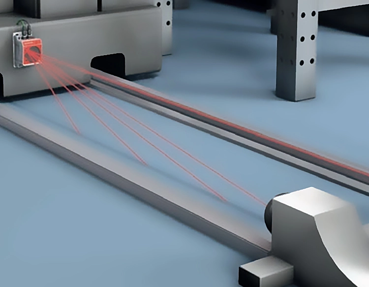
In the industrial realm, laser rangefinders are integrated into manufacturing, robotics, and construction. They enable non-contact measurement for quality control, assembly line automation, and 3D scanning. Modern surveying tools and theodolites incorporate laser ranging for fast and accurate land surveys, building information modeling (BIM), and archaeological site mapping.
The automotive industry leverages laser ranging in Light Detection and Ranging (LiDAR) systems for autonomous vehicles. LiDAR creates high-resolution 3D maps of the environment by scanning with laser beams, allowing vehicles to perceive obstacles, pedestrians, and road geometry with centimeter-level accuracy. This technology is critical for developing safe self-driving navigation systems.
Furthermore, laser ranging finds use in forestry for canopy height measurement, in aviation for altitude monitoring, and in consumer electronics for camera autofocus and gesture recognition. Its non-contact nature, high speed, and accuracy make it superior to traditional mechanical methods.
Despite its advantages, challenges like atmospheric interference, signal attenuation, and the need for a cooperative target (a reflector) for very long ranges persist. Ongoing research focuses on improving detector sensitivity, using multiple wavelengths to correct for atmospheric effects, and developing compact, cost-effective systems for mass-market applications. The future points towards even higher precision, miniaturization, and integration with other sensing technologies like radar and computer vision, promising to unlock new possibilities in science, industry, and daily life.


 +40729977919
  keysensor.ro@gmail.com