Laser ranging, also known as LiDAR (Light Detection and Ranging), is a precise measurement technique that calculates distance by emitting laser pulses and measuring the time it takes for the light to reflect off a target and return. This technology relies on the constant speed of light, approximately 299,792 kilometers per second, to achieve high accuracy over both short and long distances. The core principle involves a laser transmitter, a receiver, and sophisticated timing electronics. When a laser pulse is sent toward an object, a fraction of its light is scattered back. The receiver detects this return signal, and the system's clock measures the elapsed time, known as the time-of-flight. The distance is then calculated using the formula: Distance = (Speed of Light × Time-of-Flight) / 2.
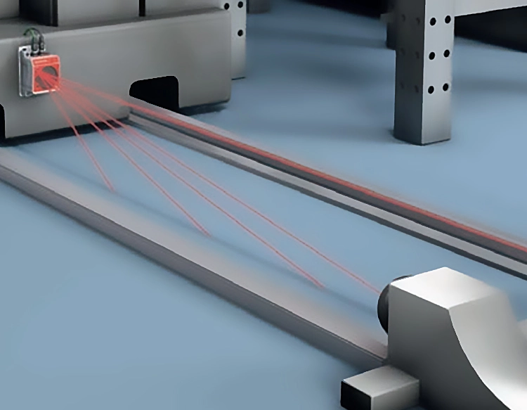
Modern laser ranging systems have evolved significantly from early experimental setups. Today, they utilize advanced components such as high-power semiconductor or fiber lasers, sensitive photodetectors like avalanche photodiodes, and high-speed digital signal processors. These improvements enable measurements with millimeter-level precision over several kilometers. Two primary methods dominate the field: pulsed time-of-flight ranging, ideal for long distances and topographic mapping, and phase-shift measurement, which offers higher precision for shorter ranges, commonly used in industrial automation and construction.
The applications of laser ranging are vast and transformative across multiple sectors. In geodesy and earth sciences, satellite laser ranging stations track orbiting satellites equipped with retroreflectors. This data is crucial for precisely determining the satellite's orbit, monitoring tectonic plate movements, and contributing to the International Terrestrial Reference Frame. For autonomous vehicles, LiDAR sensors create real-time, high-resolution 3D maps of the environment. By emitting millions of laser pulses per second, these systems detect pedestrians, other vehicles, and road boundaries, forming the perceptual foundation for navigation and collision avoidance.
In the realm of aerospace and defense, laser rangefinders are integrated into targeting systems, unmanned aerial vehicles for terrain mapping, and space missions. For instance, the Lunar Reconnaissance Orbiter uses a laser altimeter to map the Moon's topography in unprecedented detail. Industrial manufacturing and robotics employ laser sensors for quality control, aligning components, and guiding robotic arms with sub-millimeter accuracy. Furthermore, environmental monitoring benefits from airborne LiDAR surveys that measure forest canopy height, estimate biomass, and model flood plains.
Despite its advantages, laser ranging faces technical challenges. Atmospheric conditions—such as fog, rain, or dust—can attenuate or scatter the laser beam, reducing effective range and accuracy. Signal processing must distinguish the true return signal from background noise, especially in bright sunlight. Researchers are actively developing solutions, including multi-wavelength lasers to penetrate adverse weather, advanced noise-filtering algorithms, and single-photon sensitive detectors for extreme long-range or low-power applications.
The future of laser ranging is closely tied to miniaturization and integration. Solid-state LiDAR systems, which have no moving parts, are becoming smaller, more affordable, and robust, paving the way for their mass adoption in consumer electronics and smart infrastructure. Quantum-enhanced ranging techniques, leveraging quantum entanglement, promise even greater precision and security for applications in fundamental physics and secure communications. As the technology continues to advance, laser ranging will undoubtedly unlock new possibilities in scientific discovery, automation, and our understanding of the physical world.


 +40729977919
  keysensor.ro@gmail.com