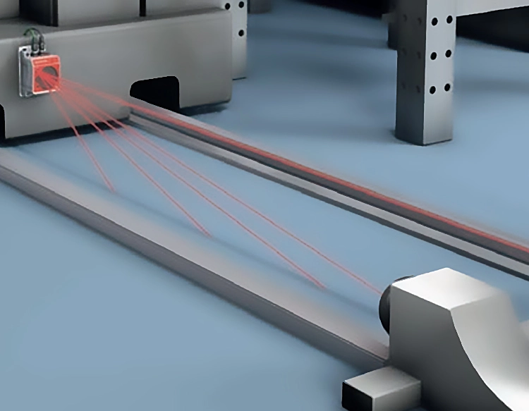
A laser scanning rangefinder sensor is a sophisticated device that combines laser ranging with scanning mechanisms to measure distances and map environments in two or three dimensions. Unlike traditional single-point rangefinders, this sensor employs a moving mirror or rotating head to deflect a laser beam across a field of view, capturing thousands of distance points per second. The core principle involves emitting short pulses of infrared or visible laser light toward a target. The sensor then calculates the time it takes for the light to reflect back to a detector, known as time-of-flight (ToF), or uses phase-shift analysis for continuous-wave lasers to determine precise distances. By systematically scanning the laser across a scene, the sensor builds a detailed point cloud—a collection of data points in space that represent the surface geometry of objects.
The technology behind laser scanning rangefinder sensors has advanced significantly, driven by improvements in laser diodes, optics, and high-speed electronics. Modern sensors often integrate inertial measurement units (IMUs) and GPS for enhanced positional accuracy, especially in mobile or airborne applications like LiDAR on drones or autonomous vehicles. Key performance metrics include scanning speed, which can exceed 100,000 points per second; range, varying from a few meters to over a kilometer depending on laser power and target reflectivity; and angular resolution, determining the density of points in the scan. Environmental factors such as rain, fog, or bright sunlight can affect performance, but many sensors incorporate filtering algorithms to mitigate noise and ensure reliable data.
Applications of laser scanning rangefinder sensors are vast and transformative across industries. In surveying and construction, they enable rapid topographic mapping, as-built documentation, and volume calculations, reducing fieldwork time and improving precision. Autonomous vehicles rely on these sensors for real-time obstacle detection and navigation, creating 3D maps of surroundings to make split-second decisions. Robotics uses them for object recognition, bin picking, and spatial awareness in warehouses or manufacturing lines. In forestry and agriculture, sensors assess tree height, canopy density, and crop health, supporting sustainable resource management. Additionally, cultural heritage preservation benefits from non-contact scanning to create digital archives of historical sites and artifacts.
The integration of laser scanning rangefinder sensors with software platforms is crucial for maximizing utility. Point cloud data is typically processed through specialized software for visualization, analysis, and integration with CAD or BIM systems. This allows users to extract measurements, generate 3D models, and simulate scenarios. As the technology evolves, trends include miniaturization for portable devices, cost reduction for broader adoption, and enhanced fusion with cameras or radar for multimodal sensing. Challenges remain in standardizing data formats and improving energy efficiency, but ongoing research promises even greater accuracy and affordability.
In summary, laser scanning rangefinder sensors represent a pivotal tool in modern measurement and mapping, offering high-speed, non-contact data acquisition with millimeter-level accuracy. Their ability to capture detailed spatial information drives innovation in fields from urban planning to environmental monitoring, making them indispensable for tasks requiring precise dimensional analysis. As advancements continue, these sensors will likely become more accessible and integral to smart infrastructure and automated systems, shaping how we interact with and understand the physical world.


 +40729977919
  keysensor.ro@gmail.com