In the demanding and often hazardous environment of modern mining operations, safety and precision are not just priorities—they are non-negotiable mandates. The introduction of Intrinsically Safe (IS) LiDAR rangefinder sensors represents a transformative leap in how mines can achieve these dual objectives. Unlike standard laser measurement tools, an IS-certified LiDAR sensor is meticulously engineered to operate in potentially explosive atmospheres, such as those containing methane gas or combustible dust, without becoming an ignition source. This fundamental safety feature unlocks a new realm of possibilities for underground and surface mining.
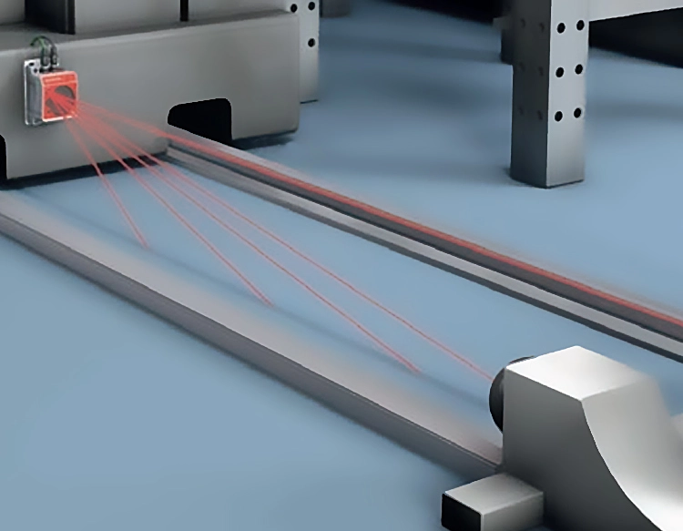
The core technology, Light Detection and Ranging (LiDAR), functions by emitting rapid pulses of laser light and measuring the time it takes for each pulse to reflect off a target and return to the sensor. This data is processed to create highly accurate, real-time three-dimensional maps and distance measurements. In mining applications, this translates to unparalleled precision in tasks like profiling mine walls, measuring stockpile volumes, monitoring slope stability, and guiding autonomous or remotely operated vehicles. The granular data provided by LiDAR far surpasses traditional manual surveying methods in both speed and accuracy, reducing human error and exposure to dangerous areas.
The intrinsic safety certification is what sets these specialized sensors apart. To earn this designation, devices undergo rigorous testing to ensure they cannot release sufficient electrical or thermal energy to ignite a specific hazardous atmospheric mixture. This is achieved through design principles that limit current, voltage, and component temperature. For mining companies, deploying IS LiDAR means they can bring cutting-edge scanning technology directly into Zone 0 or Zone 1 hazardous locations without requiring a costly and time-consuming hot work permit or a complete shutdown of operations. It enables continuous monitoring and data collection in areas previously considered too risky for electronic instrumentation.
The practical benefits are substantial. In volume calculation, for instance, an IS LiDAR sensor mounted on a vehicle or stationary pole can scan a coal or ore stockpile in minutes, generating an exact volume calculation. This improves inventory management, reconciliation processes, and logistical planning. For geotechnical monitoring, repeated scans of a highwall or tunnel roof can detect minute movements or deformations over time, providing early warning signs of potential collapses and allowing for proactive ground control measures. This application alone has profound implications for preventing catastrophic failures and protecting personnel.
Furthermore, the integration of IS LiDAR is a critical enabler for the future of automated mining. Autonomous Load-Haul-Dump (LHD) vehicles, drones for underground inspection, and robotic drilling systems rely on precise environmental perception to navigate and operate safely. An IS LiDAR sensor provides these machines with the essential "eyes" to perceive their surroundings in 3D, avoid obstacles, and execute tasks with precision, all while maintaining the highest safety standards in explosive atmospheres. This drives efficiency by allowing operations to continue in environments or during shifts that may be unsuitable for human workers.
Implementing this technology does require consideration. The initial investment is higher than for non-IS equipment, but this is offset by the reduction in safety incidents, operational downtime, and insurance premiums, alongside gains in productivity and data quality. Proper training for personnel on the operation and data interpretation is also crucial to maximize return on investment. As the technology matures, sensors are becoming more robust, with longer ranges, higher resolution, and better integration with mine planning software and IoT platforms.
In conclusion, the intrinsically safe LiDAR rangefinder sensor is more than just a measuring tool; it is a cornerstone technology for building the next generation of safe, efficient, and intelligent mines. By merging the explosive atmosphere safety of intrinsic design with the millimeter-level accuracy of LiDAR scanning, it allows the mining industry to harness powerful data analytics directly at the coal face—literally and figuratively. This synergy empowers companies to make informed decisions, protect their most valuable asset—their workforce—and optimize every aspect of the extraction process, setting a new standard for operational excellence in one of the world's most challenging industries.


 +40729977919
  keysensor.ro@gmail.com