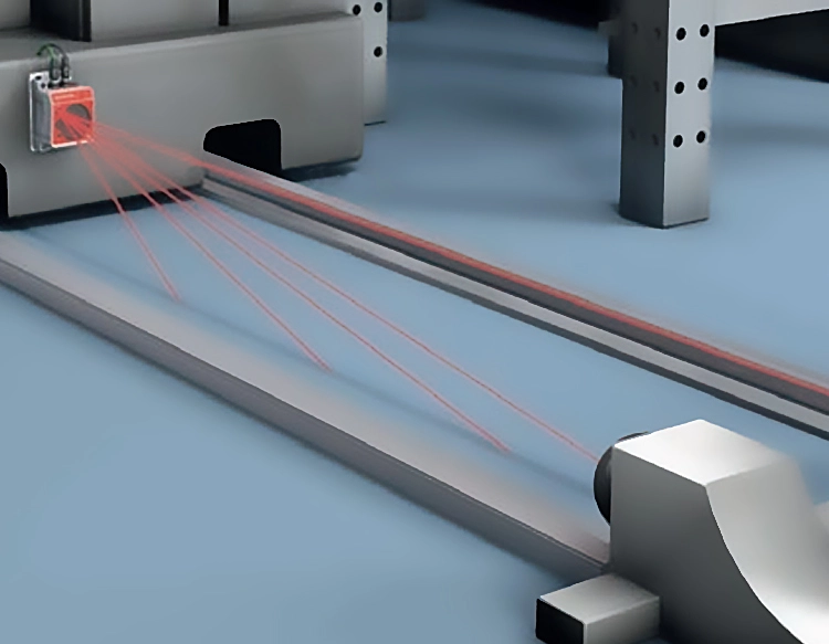
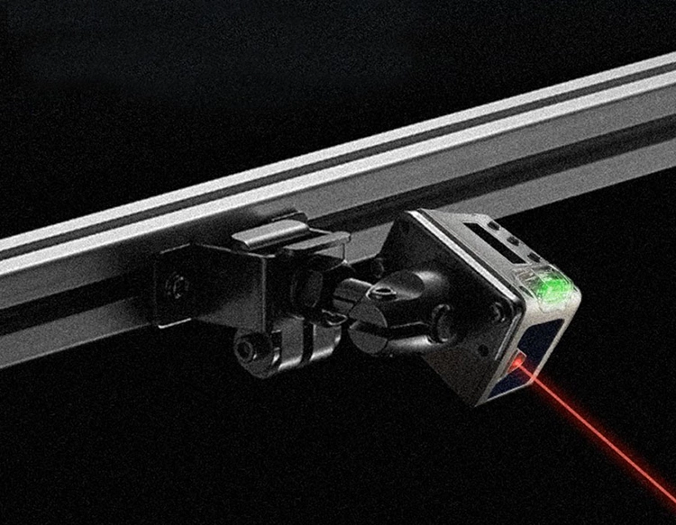
In the realm of modern measurement and sensing technology, the high-precision long-distance laser rangefinder stands as a pivotal tool, enabling accurate distance calculations over vast spans with minimal error. This device operates on the principle of time-of-flight (ToF) or phase-shift measurement, where a laser pulse is emitted toward a target, and the time taken for the reflection to return is measured. By leveraging the constant speed of light, distances can be computed with exceptional accuracy, often reaching millimeter-level precision over several kilometers. The core components include a laser diode for emission, a photodetector for receiving reflected signals, and sophisticated signal-processing electronics to filter noise and enhance reliability.
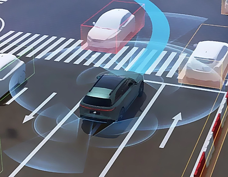
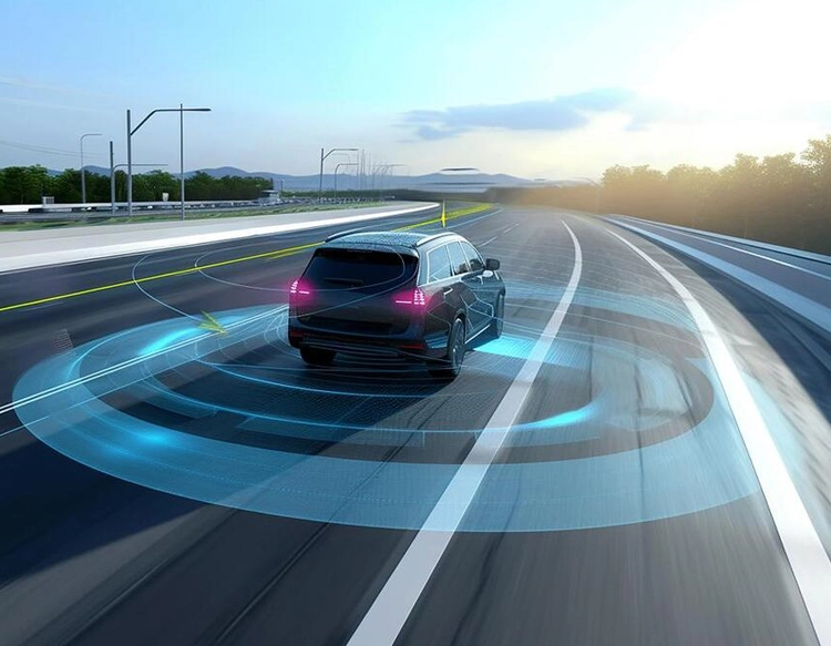
The applications of high-precision long-distance laser rangefinders are diverse and critical across multiple industries. In surveying and construction, these devices facilitate topographic mapping, building alignment, and infrastructure monitoring, reducing human error and improving project efficiency. For environmental and geological studies, they aid in tracking glacier movements, landslide detection, and forest canopy analysis, providing data essential for climate research and disaster prevention. The military and defense sectors utilize them for target acquisition, navigation, and reconnaissance, where rapid and precise distance measurement can be a decisive factor in operational success. Additionally, in autonomous vehicles and robotics, laser rangefinders serve as key sensors for obstacle detection and spatial mapping, enabling safe navigation in dynamic environments.
Advancements in laser technology and materials science have propelled the capabilities of these rangefinders. Modern units often incorporate eye-safe lasers, such as those using 1550 nm wavelengths, which comply with international safety standards while maintaining performance. Enhanced algorithms for signal processing, including wavelet transforms and machine learning-based filtering, have improved accuracy in challenging conditions like fog, rain, or low visibility. Integration with global positioning systems (GPS) and inertial measurement units (IMUs) allows for real-time georeferencing, making these devices indispensable in precision agriculture for crop monitoring and yield estimation.
Despite their advantages, high-precision long-distance laser rangefinders face challenges. Atmospheric interference, such as humidity and temperature variations, can affect laser beam propagation, leading to measurement drift. Manufacturers address this through adaptive calibration techniques and multi-wavelength systems that compensate for environmental factors. Cost remains a barrier for widespread adoption, though economies of scale and modular designs are gradually making these tools more accessible. Future trends point toward miniaturization, with compact, handheld devices offering professional-grade accuracy, and the integration of LiDAR (Light Detection and Ranging) for 3D imaging applications in urban planning and archaeology.
In summary, the high-precision long-distance laser rangefinder represents a convergence of optics, electronics, and software engineering, delivering reliable distance data that drives innovation across fields. As technology evolves, its role in automation, environmental stewardship, and scientific discovery is set to expand, underscoring its importance in a data-driven world. For professionals seeking to implement these systems, considerations include target reflectivity, operational range, and compliance with regional safety regulations to ensure optimal performance and longevity.


 +40729977919
  keysensor.ro@gmail.com


