An altitude laser rangefinder sensor is a sophisticated device that measures the distance between itself and a target by emitting a laser beam and calculating the time it takes for the beam to reflect back. This technology, often based on time-of-flight principles, provides highly accurate altitude readings, which are crucial in various fields. Unlike traditional methods that may rely on barometric pressure or GPS, laser rangefinders offer superior precision, often within centimeters, making them indispensable for applications where exact altitude data is non-negotiable.
In aviation, altitude laser rangefinder sensors are integrated into aircraft systems to enhance safety during takeoff, landing, and low-altitude flight. They help pilots navigate challenging terrains by providing real-time altitude feedback, reducing the risk of collisions with obstacles. Similarly, in unmanned aerial vehicles (UAVs) or drones, these sensors enable stable hovering and autonomous navigation, allowing drones to maintain a consistent height above ground even in dynamic environments. This capability is vital for tasks like aerial surveying, where consistent altitude ensures high-quality data collection.
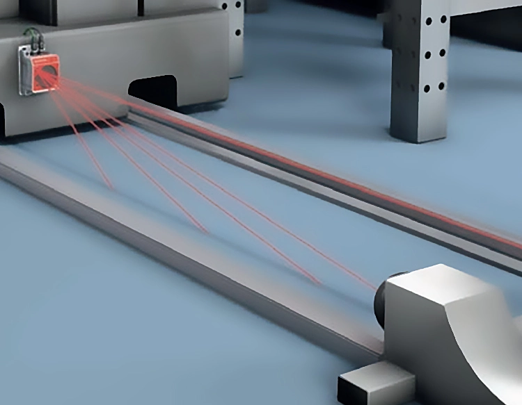
Beyond aviation, altitude laser rangefinder sensors find extensive use in industrial automation and robotics. In manufacturing settings, they assist in precision measurement and control of machinery, ensuring components are assembled at correct heights. Robotics applications leverage these sensors for obstacle detection and spatial awareness, enabling robots to operate safely in complex spaces. For instance, in warehouse automation, sensors help robotic arms and vehicles navigate shelves and items with accuracy, boosting efficiency and reducing errors.
Environmental monitoring and surveying also benefit from this technology. Surveyors use altitude laser rangefinders to map terrains, measure elevations, and monitor changes in landscapes over time. In forestry, they assess tree heights and canopy structures, aiding in resource management and conservation efforts. The sensors' ability to deliver quick, non-contact measurements makes them ideal for fieldwork, where manual methods would be time-consuming or impractical.
The core components of an altitude laser rangefinder sensor include a laser diode, a receiver, and a processing unit. The laser diode emits pulses of light, which travel to the target and reflect back to the receiver. The processing unit then calculates the distance based on the time delay, using algorithms to filter out noise and improve accuracy. Modern sensors often incorporate features like multiple echo detection, which allows them to distinguish between different surfaces, such as foliage and ground, enhancing reliability in diverse conditions.
When selecting an altitude laser rangefinder sensor, factors like range, accuracy, response time, and environmental durability come into play. Sensors designed for outdoor use typically feature rugged housings to withstand weather elements, while those for indoor applications may prioritize compact size and low power consumption. Integration with other systems, such as GPS or inertial measurement units (IMUs), can further enhance functionality, providing comprehensive spatial data for complex tasks.
In summary, altitude laser rangefinder sensors are transformative tools that deliver precise altitude measurements across industries. From improving aviation safety to enabling advanced robotics and environmental studies, their impact is broad and growing. As technology advances, we can expect these sensors to become even more accurate, affordable, and integrated into everyday applications, driving innovation in how we measure and interact with our surroundings.


 +40729977919
  keysensor.ro@gmail.com