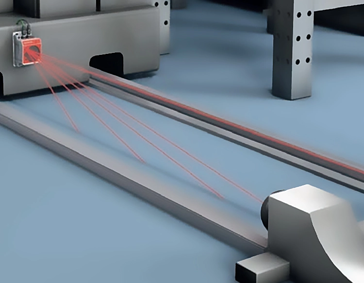
Laser ranging radar sensors, often referred to as LiDAR (Light Detection and Ranging), represent a cornerstone technology in modern precision measurement and environmental perception. Unlike traditional radar systems that utilize radio waves, these sensors emit pulsed or continuous-wave laser beams to determine the distance to a target. The fundamental principle is based on measuring the time-of-flight (ToF) of the laser pulse. A laser diode emits a short, focused light pulse towards an object. The pulse reflects off the target's surface and returns to a photodetector within the sensor. By precisely calculating the time interval between emission and reception, and knowing the constant speed of light, the sensor computes the exact distance with remarkable accuracy, often down to millimeter or even sub-millimeter levels.
The core components of a typical laser ranging radar sensor include the laser transmitter, the optical system (lenses and beam steerers), the receiver with a sensitive photodetector (like an avalanche photodiode), and sophisticated signal processing electronics. Advanced models may incorporate scanning mechanisms, such as rotating mirrors or MEMS-based systems, to capture 3D point cloud data of the surrounding environment. This capability to generate high-resolution, three-dimensional spatial maps is a key differentiator.
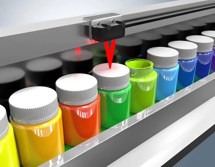
The applications of laser ranging radar sensors are vast and transformative across multiple industries. In the automotive sector, they are the primary sensing modality for most autonomous vehicle development, enabling real-time object detection, classification, and tracking for advanced driver-assistance systems (ADAS) and self-driving cars. Their high angular resolution allows them to identify pedestrians, cyclists, and other vehicles at long ranges, even in low-light conditions. In robotics and industrial automation, these sensors provide essential navigation and obstacle avoidance for mobile robots and automated guided vehicles (AGVs) within factories and warehouses. They are also crucial for precision tasks like bin picking, quality inspection, and volume measurement.
The fields of surveying, mapping, and geography have been revolutionized by airborne and terrestrial LiDAR. It is used to create highly accurate digital elevation models (DEMs), map forest canopies, monitor coastal erosion, and assist in urban planning and archaeological site discovery. Furthermore, in the realm of smart infrastructure, laser ranging sensors monitor structural health, measure vibrations in bridges and wind turbines, and manage traffic flow. Emerging applications are also found in consumer electronics, such as enabling depth-sensing for facial recognition in smartphones and enhancing gesture control in virtual and augmented reality systems.
While offering unparalleled precision and detail, laser ranging radar sensors face challenges. Their performance can degrade in adverse weather conditions like heavy fog, rain, or snow, as water particles can scatter and absorb the laser signal. They also tend to be more expensive than other ranging technologies like ultrasonic or millimeter-wave radar. However, ongoing research is focused on developing more robust, cost-effective, and solid-state solutions without moving parts, which will further expand their adoption. The fusion of LiDAR data with camera and radar inputs in sensor fusion architectures is becoming a standard approach to create redundant, reliable perception systems for safety-critical applications. As the technology continues to mature, laser ranging radar sensors will undoubtedly play an increasingly vital role in shaping a more automated and data-driven world, providing the precise eyes for machines to perceive and interact with their environment.


 +40729977919
  keysensor.ro@gmail.com