Precision distance measurement represents a critical technological domain that enables accurate spatial data acquisition across numerous fields. This capability forms the foundation for advancements in manufacturing, construction, robotics, and scientific research. The evolution from traditional mechanical tools to advanced electronic and optical systems has dramatically enhanced measurement accuracy, repeatability, and operational efficiency.
Traditional measurement tools like calipers, micrometers, and tape measures rely on direct physical contact with the target object. While suitable for many basic applications, these methods face limitations regarding accuracy over long distances, measurement speed, and accessibility to hard-to-reach areas. The development of non-contact measurement technologies has revolutionized precision assessment, particularly in industrial environments where minimal interference with processes is essential.
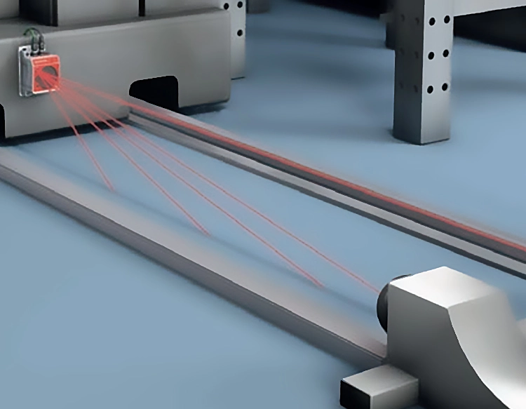
Laser-based measurement systems have become prominent solutions for high-accuracy applications. Laser rangefinders operate by emitting laser pulses toward a target and calculating distance based on the time-of-flight principle—measuring the interval between pulse emission and detection of the reflected signal. Alternative phase-shift methods analyze the phase difference between emitted and reflected continuous-wave laser beams, offering exceptional precision for shorter distances. These systems achieve sub-millimeter accuracy even at substantial ranges, making them invaluable for topographic surveys, construction layout, and large-scale manufacturing.
Ultrasonic sensors provide another non-contact approach, particularly effective in environments where optical methods face challenges. These devices emit high-frequency sound waves and measure the time until echoes return from target surfaces. While generally offering lower accuracy than laser systems, ultrasonic sensors perform reliably in conditions involving dust, smoke, or transparent materials that might interfere with optical measurements. Their cost-effectiveness and robustness make them suitable for level monitoring, proximity detection, and basic positioning tasks in industrial automation.
Industrial photogrammetry represents a sophisticated optical technique that extracts three-dimensional measurements from two-dimensional images. By analyzing multiple photographs of an object captured from different angles, specialized software reconstructs spatial coordinates through triangulation. Modern systems utilizing high-resolution digital cameras and advanced algorithms can achieve remarkable precision for complex geometries, benefiting fields like automotive design, aerospace engineering, and cultural heritage preservation.
Coordinate Measuring Machines (CMMs) combine mechanical, optical, and electronic components to deliver exceptional measurement accuracy for manufactured components. These systems use a physical probe that contacts the object's surface at multiple points, with position sensors recording precise coordinates for each contact. Advanced CMMs incorporate laser scanners and vision systems to enhance measurement speed and capability for free-form surfaces. As fundamental tools in quality control laboratories, they verify dimensional compliance for critical components in medical devices, automotive parts, and aerospace assemblies.
Global Navigation Satellite Systems (GNSS), including GPS, GLONASS, and Galileo, enable distance measurement across vast geographical scales. While standard positioning offers meter-level accuracy, advanced techniques like Real-Time Kinematic (RTK) and Precise Point Positioning (PPP) achieve centimeter-level precision by correcting signal errors. These technologies support applications ranging from agricultural machinery guidance and construction site management to tectonic plate movement monitoring and autonomous vehicle navigation.
Emerging technologies continue to push precision boundaries. Laser interferometry measures minute distance variations by analyzing interference patterns between split laser beams, achieving nanometer-scale resolution for semiconductor manufacturing and scientific instrumentation. Frequency-Modulated Continuous-Wave (FMCW) LiDAR enhances automotive and robotic perception by simultaneously measuring distance and velocity with high resolution. Quantum-based sensors exploiting atomic properties promise unprecedented accuracy for future geodesy and fundamental physics research.
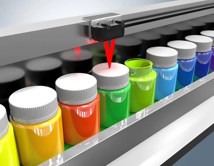
The selection of appropriate measurement technology depends on specific application requirements including needed accuracy, measurement range, environmental conditions, target material properties, and operational constraints. Industrial applications increasingly integrate multiple sensor types within automated systems, combining their respective strengths through data fusion algorithms. This integration enables comprehensive spatial monitoring throughout production processes, from raw material inspection to final product verification.
Standardization and calibration maintain measurement reliability across industries. Organizations like the International Organization for Standardization (ISO) establish protocols ensuring consistency and traceability to international measurement standards. Regular calibration against certified references prevents accuracy drift in measurement equipment, a critical consideration for industries subject to regulatory compliance and quality certification requirements.
Future developments will likely focus on enhancing measurement speed, reducing system costs, and improving robustness in challenging environments. Integration with artificial intelligence and machine learning will enable predictive maintenance of measurement systems and intelligent interpretation of complex spatial data. As industries pursue tighter tolerances and smarter manufacturing processes, precision distance measurement technologies will remain indispensable tools for quality assurance, process optimization, and technological innovation across the global industrial landscape.


 +40729977919
  keysensor.ro@gmail.com