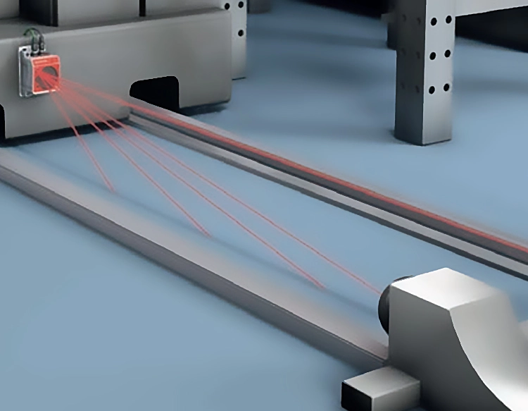
Distance scanning technology has revolutionized how industries measure, map, and interact with physical spaces. A distance scanner, often referred to as a laser scanner or LiDAR (Light Detection and Ranging) device, emits laser pulses to calculate the distance between the scanner and objects in its environment. By capturing millions of data points per second, it creates precise three-dimensional representations known as point clouds. These detailed models enable professionals across various sectors to analyze structures, monitor changes, and plan projects with unprecedented accuracy.
The core mechanism of a distance scanner involves time-of-flight measurement. When a laser beam hits a surface, it reflects back to the scanner's sensor. The device calculates the distance based on the time taken for the beam to return, using the formula: distance = (speed of light × time) / 2. Advanced scanners incorporate inertial measurement units (IMUs) and GPS to enhance spatial referencing, ensuring data aligns with real-world coordinates. This technology operates effectively in diverse conditions, from indoor settings to outdoor terrains, though factors like reflectivity and ambient light can influence performance.
In construction and architecture, distance scanners streamline building information modeling (BIM) and site inspections. Engineers use them to capture as-built conditions, detect deviations from blueprints, and assess structural integrity without physical contact. For example, scanning historical buildings helps preserve delicate structures by identifying cracks or shifts over time. Similarly, in manufacturing, scanners quality-check components by comparing digital models to physical products, reducing errors and speeding up production cycles.
The automotive and robotics industries rely on distance scanners for navigation and safety. Autonomous vehicles integrate LiDAR to perceive surroundings, avoiding obstacles and enabling real-time decision-making. In robotics, scanners guide machines in warehouses or hazardous environments, such as nuclear facilities, where human access is limited. Additionally, agriculture benefits from this technology through crop monitoring and yield prediction, where scanners map fields to optimize irrigation and fertilization.
Environmental monitoring and archaeology also leverage distance scanning. Researchers employ airborne LiDAR to survey forests, tracking deforestation or carbon sequestration. In archaeology, scanners uncover hidden ruins beneath vegetation by penetrating foliage with laser pulses, revealing ancient landscapes without excavation. This non-invasive approach protects sites while providing valuable historical insights.
Despite its advantages, challenges like high costs, data processing demands, and sensitivity to weather conditions persist. However, innovations in solid-state LiDAR and AI-driven analytics are making scanners more affordable and efficient. As technology evolves, distance scanners will likely become integral to smart cities, virtual reality, and disaster response, offering new ways to understand and shape our world.
To maximize a distance scanner's utility, users should consider factors like range, accuracy, and software compatibility. Regular calibration and proper training ensure reliable results. Whether for industrial automation or scientific research, this tool exemplifies how precision measurement drives progress, bridging gaps between digital and physical realms.
In summary, distance scanners transform raw spatial data into actionable insights, fostering innovation across fields. By embracing this technology, industries can enhance efficiency, safety, and sustainability, paving the way for a more connected future.


 +40729977919
  keysensor.ro@gmail.com